
Overview
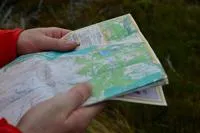
Orienteering requires navigational skills using a map and compass to navigate from point to point. Participants use a specially prepared orienteering map, which they use to find control points. We have created several maps to help you combine map reading skills and physical exercise whilst being able to enjoy the natural surroundings of a park.
Bulwell Hall Orienteering Map
Arboretum Orienteering Map
Colwick Park Orienteering Map
Southglade Park Orienteering Map
Wollaton Park Orienteering Map
Woodthorpe Park Orienteering Map
Forest Rec Orienteering Map
Harvey Hadden Sports Village Orienteering Map
Find out more about parks and open spaces
Contact
Downloads
- Arboretum Orienteering Map (opens in new tab)pdf file[667KB]
- Bulwell Hall Orienteering Map (opens in new tab)pdf file[831KB]
- Colwick Park Orienteering Map (opens in new tab)pdf file[830KB]
- Forest Rec Orienteering Map (opens in new tab)pdf file[665KB]
- Harvey Hadden Orienteering Map (opens in new tab)pdf file[898KB]
- Southglade Park Orienteering Map (opens in new tab)pdf file[715KB]
- Wollaton Park Orienteering Map (opens in new tab)pdf file[771KB]
- Woodthorpe Park Orienteering Map (opens in new tab)pdf file[752KB]